Surveying
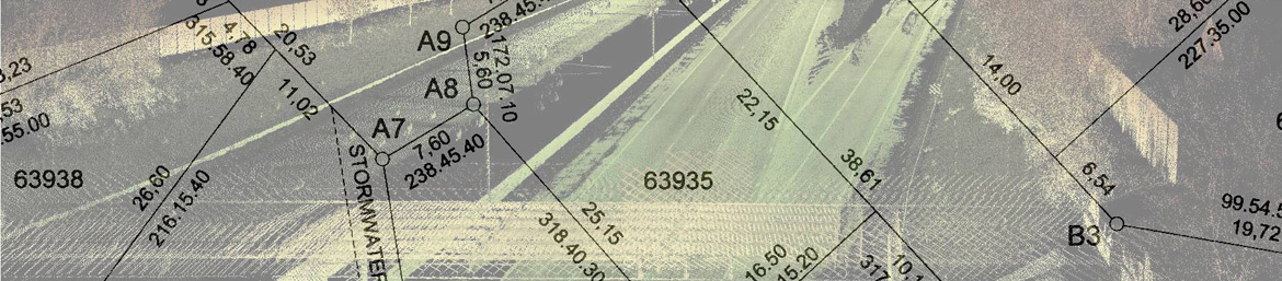
Cadastral Survey
This involves the creation and determination of rights over land. We offer a number of cadastral surveys - General plans, Sub-divisions, Servitudes, Replacement of beacons, Sectional titles, Consolidations.
LIDAR Survey
Lidar is a scanning technology that allows for the collection and recording of information about an object, through combining laser light and positioning measurements. This results in the creation of a real image of the object that is being scanned as a result of capturing millions of points with XYZ values. We offer the use of the following LIDAR scanning technologies - static and mobile LIDAR scanners.
Topographic Survey
This type of survey establishes the different manmade and natural features of the land. A topographical survey will have a scaled drawing showing actual outline of features and contours illustrating relief.
Volumetric Survey
Do you need to keep accurate records of stockpiles? We employ the latest in LIDAR and UAV technology in computing volumes of your stockpiles. Our approach is efficient and saves you money.
As-built Survey
We provide both on-site and off-site technical support.