Remote Sensing
Forestry
Forestry can benefit immensely in the use of GIS and remote sensing technologies. Some of the applications of remote sensing include tree species surveys, monitoring clear cut operations, planning and observing burn areas, studying successional forest growth, distinctions between cover types, and for taking general inventories of forest densities.
Agriculture
Agriculture can benefit immensely in the use of GIS and remote sensing technologies. Some of the applications of remote sensing in agriculture include the following, measuring various vegetation indices, identifying soil properties by their spectral signals, evaluating crop productivity, and providing a valuable data source for crop simulation models.
Imagery
We are able to provide you with the appropriate imagery. We have access to the most comprehensive range of commercial earth observation (multi-resolution and multi-source) data
Feature Extraction
We can extract vector features from high-resolution satellite or aerial photography. Various features can be extracted from imagery; these include roads, railroads, bridges, airports/landing strips, streams, rivers, lakes & dams, electricity transmission lines, building foot prints. The extracted features can include attribution, for instance roads can be classified by type.
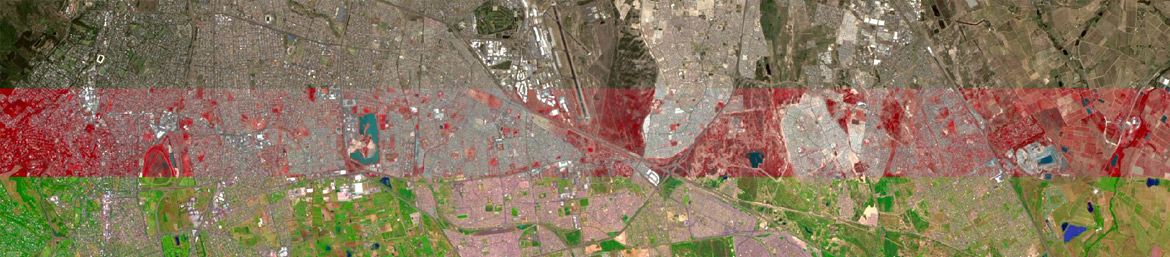
Land Cover and Change Detection
The landscape is in a constant state of change as a result of natural and man-made activities. Our land cover classification products provide information quantifying land cover types and changes on the landscape.